Showing posts with label FDOT. Show all posts

Wednesday, September 11, 2019

Pedestrian, bicycle improvement projects moving along


Florida Weekly 'Outdoors' column, September 11, 2019
danMOSER
bikepedmoser@gmail.com

A rending of the temporary improvement on Fowler Street looking south toward Hanson Street. COURTESY IMAGE

As Lee County and all of Southwest Florida continues to grow at a breakneck pace many transportation projects are taking place as well. While most road improvement projects or new road development include sidewalks or shared-use paths and sometimes even bike lanes, the fact is that what generally continues to be designed and built are facilities intended to move motor traffic as quickly and efficiently as possible with non-motorists being treated as secondary users.

This approach means pedestrians and those on bicycles continue to face dangers and difficulties when navigating our public rights of way. In fact, many of the improvement projects turn our streets and roads into full-fledged highways with design speeds increased by 10 mph or higher than the posted speed limit (usually 40 mph higher), making using them a challenging and largely unpleasant task for non-motorists.

Here are a few project updates.

¦ Fowler Street from Hanson Street to MLK/SR-82 is the last segment of the Metro corridor stretching from Alico Road in south Fort Myers to just north of the Shell Factory in North Fort Myers. It’s been left unimproved for decades and is the definition of a dysfunctional road segment. Although it’s under the jurisdiction of FDOT, the city of Fort Myers has held up any kind of improvement since the late 1980s, all at the expense of pedestrians and cyclists. There are no sidewalks or even usable shoulders, not to mention driver safety is compromised, as it’s a four-lane road with no median or left- turn lanes. FDOT and Fort Myers have finally come to a tentative agreement on at least an interim plan that provides accommodation for pedestrians (bicycle users will be accommodated on parallel Evans Avenue with the addition of an on-road, two-way cycle track; the existing sidewalk will remain on Evans). As part of the plan, Evans will turn one of its three northbound lanes into a southbound one; Fowler will have two southbound lanes and one northbound.

Dan Moser is a long-time bicycle/pedestrian
advocate and traffic safety professional
who cycles, runs and walks regularly for
transportation, recreation and  fitness.
Contact him at bikepedmoser@gmail.com
and 239-334-6417.
The fact that FDOT is willing to take this temporary approach after almost 40 years of taking no action tells me there’s really no satisfying the city of Fort Myers, so what a final plan might be remains to be seen. This segment is appropriate for a one-way pair as there are a number of perpendicular streets running between Evans and Fowler, allowing for easy access to locations on both streets. But because the city has dug in against a one-way pair (even though that’s what exists from MLK to both spans of the Edison Bridge) we’re stuck with this temporary solution which may last for another few decades.

¦ The spine of Lee County’s trail network runs adjacent to the rail line between U.S. 41 and Metro Parkway and includes John Yarbrough Park Trail (JY Trail), which currently exists from Six Mile Cypress Parkway to Colonial Boulevard. The next phase continues north to Hanson. This is indeed welcome news. But there’s really no plan to extend it as a pathway that’s not along a highway from Hanson (it’ll run along Metro/Evans from there and the path is a sidewalk not a shared-use path). Additionally, one of the key features that was supposed to be part of this extension will not come to be: there will be no direct connection between JY Trail and North Colonial Linear Trail. FTOD even redesigned the Metro overpass just north of Winkler Avenue to accommodate this planned connection.

¦ On the southern end of JY Trail a long-overdue trailhead parking lot is in the works. Lee County purchased property west of Metro and the railroad tracks and east of Independence Circle and is currently designing the trailhead facility, which is slated to be constructed in 2020.

¦ The SUNTrail statewide trail system segment in Cape Coral is making progress. This 12-foot wide, 6.5-mile project runs from Burnt Store Road to the east along Van Buren Parkway, El Dorado Boulevard and Kismet Parkway, terminating at Del Prado Boulevard. It’s broken into two phases with design of phase 1 — from Burnt Store to Nelson Road — about complete and construction slated to begin next year. What should be interesting is how a segment east of Del Prado that’s necessary to meet up with the north-south SUNTrail corridor in North Fort Myers along 41 will be dealt with. Lee County is currently designing a realignment to directly connect Littleton Road to Kismet, but it does not appear to be including a shared-use path facility along it in the plan.

To learn about this topic and more, visit bikewalklee.blogspot.com and www.streetsaliveswfl.org


For Lee County cycling and tri events visit Caloosa Riders Bicycle Club (caloosariders.org); Florida Mudcutters (mudcutters.org); and SW Florida Biking Meetup Group (meetup.com/Biking-SWFL). The Florida Bicycle Association (floridabicycle.org) is your source for statewide happenings. BikeWalkLee’s blog site has all the information you’ll need to stay abreast of advocacy efforts in Southwest Florida as well as statewide and nationally.


Tuesday, January 29, 2019

Action Alert: Attend Feb. 7th public hearing for Able Canal Pathway Project in Lehigh Acres


If you live, work, or play in Lehigh and support the proposed 5.5 mile pathway that will connect Lehigh Acres Trailhead Park, to the Lehigh Acres Community Park and the Harnes Marsh, allowing residents and visitors to bike or walk between these popular destinations, now is the time to make your voices heard. This FDOT-funded project has been in the study/planning phases since 2013, and is now at the stage of a public hearing prior to approval of the location of the pathway along the canal and its conceptual design.  This is your chance to review the proposal and share your views with FDOT, Lee County, and MPO staff.

  It's important that pathway supporters attend this public hearing to show their support for moving forward to implementation of this important project.

Read  BWL's March 2017 blog post for background on the project and BWL's April 2018 blog for background on the open house to review alternatives under consideration.

 FDOT Press Release:

The Florida Department of Transportation (FDOT), District One, invites you to attend a public hearing for the Able Canal Pathway from Harns Marsh to Joel Boulevard (CR 884) project in Lee County, Florida. 

Public hearing:
  • Date: Thursday, February 7, 2019
  • Time5 p.m. Open house
  •  6 p.m. Formal presentation and public comment period
  • LocationVeterans Park Recreation Center
  •  55 Homestead Road South
  •  Lehigh Acres, FL 33936
Location of Able Canal Corridor
The proposed improvements consist of constructing a new shared-use pathway along the north side of Able Canal where there is currently no continuous path. This public hearing is being conducted to give interested persons an opportunity to express their views concerning the location, conceptual design, and social, economic, and environmental effects of the proposed improvements.

Draft project documents will be available for public review from Thursday, January 17, 2019 to Monday, February 18, 2019 at the following locations: East County Regional Library, 881 Gunnery Road North, Lehigh Acres, FL 33971 and FDOT District One, Southwest Area Office, 10041 Daniels Parkway, Ft. Myers, FL 33913.

The environmental review, consultation, and other actions required by applicable federal environmental laws for this project are being, or have been, carried out by FDOT pursuant to 23 U.S.C. §327 and a Memorandum of Understanding dated December 14, 2016 and executed by the Federal Highway Administration and FDOT.

FDOT solicits public participation without regard to race, color, national origin, age, sex, religion, disability, or family status. People who require special accommodations under the Americans with Disabilities Act or who require translation services (free of charge) should contact Cynthia Sykes, District One Title VI Coordinator, at (863) 519-2287, or e-mail at Cynthia.Sykes@dot.state.fl.us at least seven days prior to the public meeting.

If you have questions about the project or scheduled public hearing, please contact Steven Andrews, Project Manager at (863) 519-2270 or by e-mail to steven.andrews@dot.state.fl.us at least seven days prior to the hearing. You can also visit the project website at www.swflroads.com/ablecanalpathway.

Wednesday, June 6, 2018

Invite to June 19th Open House on Proposed Bayshore Rd. Pathway

Do you live, work, or play in Bayshore Road area (State Road 78)?  Here's your chance to find out the options FDOT is considering for a proposed pathway on Bayshore Rd. Stop by the Open House on Tuesday, June 19th (any time from 5-7 p.m.) to learn more and provide your input.


June 5, 2018                                                                           
                                                                                                   Zachary.Burch@dot.state.fl.us

 
FDOT Public Information Meeting for Bayshore Road (State Road 78) Pathway

from Park 78 Drive to State Road 31 in Lee County

Fort Myers, FL – The Florida Department of Transportation (FDOT), District One, is holding a public information meeting about the Project Development and Environment (PD&E) study for the proposed pathway improvements along Bayshore Road from Park 78 Drive to State Road 31 in Lee County, Florida.

The meeting will be held from 5 p.m. to 7 p.m. on Tuesday, June 19, 2018, at the Lee Civic Center, Whaley Hall Building at 11831 Bayshore Road, Fort Myers, FL.

The meeting will be an open house format with a video presentation playing continuously throughout the meeting. There will be no formal presentation. Department staff will be available to discuss the project, to receive public input, and to answer any questions.

This meeting is being held to allow interested persons an opportunity to be informed and provide comments concerning the location; conceptual design alternatives; and social, economic, and environmental effects of the proposed project for the Bayshore Road (State Road 78) Pathway. The proposed project will provide a safe, viable non-motorized travel option for commuters and recreational users along the Bayshore Road corridor and the Fort Myers community, improving multimodal accessibility to area destinations while minimizing potential impacts to the natural and human environments. Alternatives being evaluated for this project include either a sidewalk or a shared use path on the north or the south side of Bayshore Road. The No-Build Alternative, which assumes that no pathway will be provided along Bayshore Road through the year 2040, is also an option and will remain a viable alternative throughout the PD&E study.

You can also stay current with the project and share comments with the study team by visiting the Bayshore Pathway web page at www.swflroads.com/bayshorepathway.


Sunday, April 8, 2018

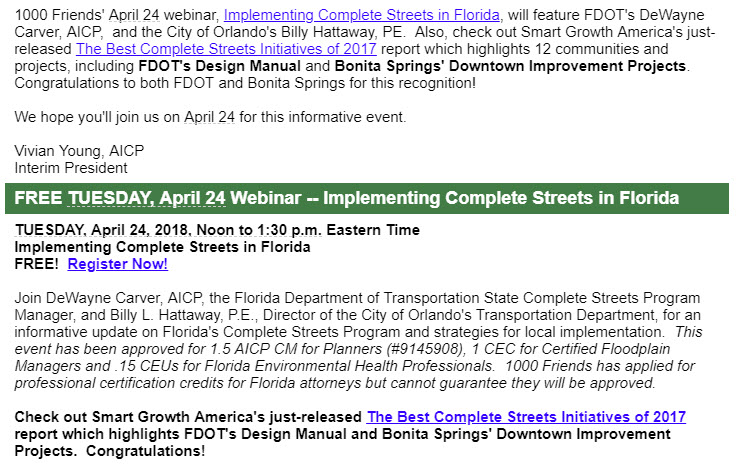
April 24th Webinar on Implementing Complete Streets in Florida.

Sign up now to learn more about implementing Complete Streets in Florida from FDOT's DeWayne Carver and Orlando's Billy Hattaway.


Monday, March 12, 2018

Save the date: April 19th - Creating the Future Today

Mark your calendars for this important event presented by Streets Alive of  SWFL, Florida CCIM Chapter Southwest District and Lee County Economic Development Southwest Florida.


The Summit is scheduled for April 19, 2018, and will feature experienced speakers on topics that include “Integrating Land Use, Transportation, and Economic Planning”.

SPEAKERS:

VICTOR DOVER, AICP
Dover, Kohl & Partners
Victor has a national and international portfolio of work emphasizing community revitalization.

IAN LOCKWOOD, P.E.
Toole Design Group
Ian is a national leader in sustainable transportation policy and urban design, with extensive background in both public government and private consulting.

BILLY HATTAWAY, P.E.
City of Orlando
Working closely with a Smart Growth America Advisory Team, Billy initiated and developed Florida’s new Complete Streets program, called Context Classification.

JOE MINICOZZI, AICP
Urban 3
Joe’s analyses help localities make better decisions, measuring investments against ROI, through identification and comparative assessment of revenue streams.

DEWAYNE CARVER, AICP
FDOT Complete Streets Team
The new state-wide Context Classification Program will be presented.

Registration here and more information here.


For more information contact: AnnPierce350@gmail.com


Tuesday, January 23, 2018

John Yarbrough Linear Park (JYLP) Phase IV Feasibility Study and Winkler Canal Shared-Use Path Feasibility Study

All interested parties are invited to attend Monday’s public meeting about the John Yarbrough Linear Park and Winkler Canal Shared-Use Path Feasibility Studies.

Fort Myers, Florida 

The City of Fort Myers will hold a public information workshop on the John Yarbrough Linear Park Phase IV Feasibility Study and Winkler Canal Shared-Use Path Feasibility Study from 5 p.m. to 7 p.m. (5:30 p .m. presentation) on Monday, January 29, 2018 at the Wesley Memorial United Methodist Church, 4141 DeLeon Street, Fort Myers, FL, 33901. The City has entered into a Joint Participation Agreement with the Florida Department of Transportation (FDOT) to undertake two projects described as the John Yarbrough Linear Park Phase IV Feasibility Study and Winkler Canal Shared-Use Path Feasibility Study.


John Yarbrough Linear Park Phase IV Feasibility Study

Located within the City of Fort Myers and unincorporated Lee County, the John Yarbrough Linear Park Trail is an existing, non-motorized transportation and recreation corridor, currently extending approximately six (6) miles, from Six Mile Cypress Parkway to Colonial Boulevard. The City has entered into a Joint Participation Agreement with the FDOT to determine the viability of extending the John Yarbrough Linear Park Trail approximately 1.8 miles north, from Colonial Boulevard to Hanson Street.


Winkler Canal Shared-Use Path Feasibility Study

The City of Fort Myers is seeking to determine the feasibility of constructing a shared-use path between Winkler Canal and the Fort Myers Country Club/Hill Avenue from west of US 41/Cleveland Avenue to McGregor Boulevard. The Feasibility Study will identify right-of-way, concept design, safety, security, maintenance, and environmental issues related to development of a 10-foot wide shared-use path within the project study area.

The workshop is an opportunity for the public to review and comment on the status of the studies. City of Fort Myers staff and the project team will be available to answer your questions about the studies.

If you have questions about the projects or scheduled public workshop, please contact Cella Molnar & Associates, Public Information Consultant for these City of Fort Myers projects at (239) 337-1071 or email to mavola@cella.cc.


Date: Monday, January 29, 2018
Time: 5 p.m. to 7 p.m.
(5:30 p.m. presentation)
JYLP Phase IV Feasibility Study presentation to begin first and Winkler Canal Shared Use Path Study to follow. 
Place: Wesley Memorial United Methodist Church
4141 DeLeon Street (next to Orangewood Elem. School)
Fort Myers, FL 33901


Thursday, October 5, 2017

FDOT Context Classification Complete Streets Handbook and Design Manual Workshop Rescheduled for Nov. 6th

Due to Hurricane Irma, this FDOT workshop scheduled for Sept. 19th was postponed.  The new date is Nov. 6th.  Local governments (officials and staff) and their partners (including complete streets/bike/ped advocates) are encouraged to attend.  RSVP now.


 Previous BWL Blog:
6/30/17: Save the Date: FDOT Workshop Sept. 19th on Complete Streets Handbook and Design Manual

Tuesday, September 5, 2017

Action Alert: Support Seminole Gulf Railroad corridor trail between Bonita Springs and Estero--Ask State to restore trail to Priority Florida Greenways and Trails Map

Background


Since BikeWalkLee's inception in 2009, it has been a strong supporter of the vision of a connected and integrated statewide trail system throughout Florida.  [BWL 2016 Letter ] While a statewide trail map was developed in 1998, the initiative gained momentum beginning in 2014 when the State Legislature provided annual funding ($25 M/year) for the SUN Trail program that uses the Florida Greenways and Trails Plan and maps to prioritize funding for the system.  This Plan and maps (last updated in 2015) will guide implementation of the connected statewide trail system from 2018 through 2022.  Since 2015, the Lee MPO has proposed several new segments for the trail, which need to be incorporated into the updated maps.

We are concerned that the revised statewide trail maps contained in the draft FGTS update have deleted the Seminole Gulf Railroad right of way corridor between Bonita Springs and Estero that has been on the FGTS map since the beginning
as the primary spine for the Southwest Coast Connector (aka Gulf Coast Trail) in Lee County,.  It is critical that this trail be added back as a Priority trail before the update is finalized.  Why is this important? Because being a "Priority Trail" gives you priority for SUN Trail funds.  Bonita and Estero officials have been working jointly over the past 8 months to move this "rails-to-trails" project forward, with strong support from their communities. 


Please submit comments in support of this project as requested in the Lee MPO's email request (see below), or attend next week's public workshop in North Port (9/14) to express your support in person.  Thank you! 
 
Introduction (by Office of Greenways and Trails)

"The Florida Greenways and Trails Plan establishes the vision for implementing a connected statewide system of greenways and trails for recreation, conservation, alternative transportation, healthy lifestyles, a vibrant economy, and a high quality of life. The Office of Greenways and Trails (OGT) is updating the FGTS 5-Year Plan and holding 14 public open houses throughout the state. "


Lee MPO Email 9/5/17:
URGENT: Please Submit Comments to Office of Greenways and Trails to Restore the Seminole Gulf Alignment to the Priority Trails Map


The Florida Department of Environmental Protection has released itsFinal Draft Priority Trails Map for the Southern Region that includes Lee County, and it is disappointing to see that they have removed the Seminole Gulf Railroad (SGLR) alignment from the Draft 2018-2022 Update of the Priority Trails Map. This is inconsistent with the Lee MPO Board resolution that was adopted back in February 17, 2017 which urged the Florida Greenways and Trails Council to (1) add the proposed Coastal Loop to the Priority Trails Map while (2) maintaining the SGLR Right of Way as the primary spine for the Southwest Coast Connector (aka Gulf Coast Trail) in Lee County, and thereby continuing to maintain that alignment in the Priority Trails Map. That resolution was transmitted to the FDEP Office of Greenways and Trails (OGT) staff on the same day it was adopted by the Lee MPO. 

Staff had subsequent discussions with OGT staff where we had consistently and repeatedly urged OGT staff to recommend that the SGLR alignment be maintained while adding the Coastal Loop in the Draft Priority Trails Map Update. They had said that the OGT Council would not approve loops in urban areas, yet OGT staff went and added a proposed loop trail requested in Sarasota Manatee County in the draft Priority Trails Map for Council consideration, but denied our request. The Sarasota loop trail can be found in the West Central Florida Region Map.

A Joint Resolution was adopted by the Central Florida MPO Alliance and the TBARTA MPO Chairs Coordinating Committee in June 16, 2017, that had endorsed the Lee and other MPOs proposed changes to alignments in their respective counties to the South West Coast Connector (aka Gulf Coast Trail).

Please fill the attached comment sheet [Comment Form]:
asking OGT Council and staff to restore the SGLR ROW alignment in the Southern Region Draft Priority Trail Map. Make sure that you ALSO write in the comment sheet expressing your thanks and support to OGT staff for adding the Coastal Loop and the SR 78/80 Corridor in Lee County to the Draft Priority Trails Map. 

 In addition to Samantha Browne, please cc OGT Council Chair Brian Smith at smithozona@gmail.com . We would like you to send your comments as soon as possible, and if possible attend one of the public open houses either in Sebring or North Port for input on the draft priority map for the Southern Region to express your concerns in person. The open houses in Sebring and North Port are as follows:

9/6/17 UPDATE: SEPT. WORKSHOPS POSTPONED DUE TO HURRICANE IRMA
 
"The Public Workshops scheduled for September (see below) will be rescheduled for a later date due to the potential of Hurricane Irma impacting the state.  This will allow individuals to focus on preparing their communities and families for the storm.  The Office of Greenways and Trails will send out more information once new dates have been confirmed."

Thursday, September 14 – North Port
Morgan Family Community Center, Meeting Room A/B
6207 West Price Boulevard, North Port, FL 34291
4:00-7:00 ET


Monday, September 11 - Sebring
Bert J. Harris, Jr. Agricultural Center, Conference Room #2
4509 George Boulevard, Sebring, FL 33875

4:00-7:00 ET


Related BikeWalkLee Blog Posts:


October 12, 2016: Cape Receives $1.8 Million SUN Trail Grant to Design Multi-Use Trail in North Cape

March 9, 2016: Moser Column: Cross-country bicycling network offers local benefits

March 7,2016: BikeWalkLee supports Southwest Coastal Regional Trail


Report by Darla Letourneau

Friday, August 4, 2017

Public Hearing for Six Mile Cypress Parkway/Gladiolus and US 41 Intersection Improvements Project


FDOT announces a public hearing about plans to improve Lee county's most dangerous intersection. The meeting will be held on Thursday, August 17, 2017, at the Florida Southwestern State College. All interested parties are invited to attend.

Fort Myers, FL -- The Florida Department of Transportation (FDOT), District One, is holding a public hearing about design plans to improve the intersection of Six Mile Cypress Parkway/Gladiolus Drive (SR 865) and US 41 in Lee County. The hearing will be held on Thursday, August 17, 2017, at the Florida Southwestern State College, 8099 College Parkway, Building AA, Room 177, Fort Myers, FL 33919.

There will be an open house at 5 p.m. during which staff will be available to discuss the project and answer questions, followed by the formal hearing presentation at 6 p.m., after which participants may provide verbal or written comments. People attending the meeting can review project displays and speak one-on-one with project team members about the proposed capacity and safety improvements to Six Mile Cypress Parkway/Gladiolus Drive (SR 865) and US 41.

The project will add an additional westbound through lane on Six Mile Cypress Parkway, increase capacity of the eastbound turn lanes, and improve the pedestrian crossings at the intersection. As part of these improvements, the closure of the eastbound left turn entrance for the Parker Promenade shopping plaza west of the intersection is being considered. The estimated construction cost is $2.1 million and construction should begin during the summer of 2018.

The draft project documents and other information will be available for public review from July 27 through August 28, 2017 at the Lakes Regional Library, 15290 Bass Road, Fort Myers, FL 33919.

FDOT developed this meeting in compliance with Title VI of the Civil Rights Act of 1964 and related statutes. Public participation is solicited without regard to race, color, national origin, age, sex, religion, disability or family status.  Persons wishing to express their concerns relative to FDOT compliance with Title VI may do so by contacting Jamie Schley, FDOT District One Title VI Coordinator by phone at 863-519-2573, or via email at Jamie.Schley@dot.state.fl.us.

People requiring special accommodations pursuant to the Americans with Disability Act of 1990 or people that require translation services (free of charge) at the meeting should contact project manager, Randy Lachler at 863-519-2548 or by e-mail to Randy.Lachler@dot.state.fl.us at least seven (7) days prior to the meeting. If you are hearing or speech impaired, please contact us by using the Florida Relay Service, 1-800-955-8771 (TDD) or 1-800-955-8770 (Voice).

SWFLRoads.com | @MyFDOT_SWFL | facebook.com/MyFDOTSWFL

Friday, June 30, 2017

Save the Date: FDOT Workshop Sept. 19th on Complete Streets Handbook and Design Manual

Mark your calendars now and plan to attend FDOT's half-day interactive workshop Sept. 19th about how to incorporate the new FDOT Design Manual and Complete Streets Handbook into the planning process.  For more background, read BikeWalkLee's May 3rd blog post: FDOT delivers on its Complete Streets Implementation Plan.


Wednesday, May 3, 2017

FDOT delivers on its Complete Streets Implementation Plan

Kudos to FDOT for delivering on a major milestone  of its Complete Streets Implementation Plan--issuance of a draft FDOT Design Manual to replace its current Plans Preparation Manual.  In addition, the Department has prepared a Draft Complete Streets Handbook to accompany the new FDOT Design Manual.   Highlighting the national significance of this FDOT project, last week  the team leader of the project, DeWayne Carver, State Complete Streets Program Manager for FDOT, received a national award for this effort. (See  Congress of New Urbanism (CNU) Transect Codes Council Honor FDOT's DeWayne Carver with Groves Award.)
DeWayne Carver

Background
Since FDOT announced its Complete Streets Policy in 2014, FDOT has worked to transform the way FDOT designs roads  and conducts business .  The goal of FDOT's Policy and Complete Streets Implementation Plan (2015) is to "provide safer, context-sensitive roads by putting the right street in the right place."  [1000 Friends of Florida 2/12/16 Webinar Description.] The highly acclaimed Implementation Plan outlines plans for updating the key manuals and guidance that FDOT engineers use to design roads.  The accompanying Complete Streets Handbook was not part of the plan, but has been developed as an interim document with guidance to FDOT and local partners. The Plan called for full implementation by the end of 2017. 

FDOT Complete Streets Handbook and Design Manual
Last week FDOT issued the draft Complete Streets Handbook and the draft FDOT Design Manual.  The FDOT Design Manual is the "meat and potatoes" of the Implementation Plan. Both the Handbook and the FDOT Design Manual focus on the state road system.  The Handbook describes  the approach and process that FDOT will use to plan state roadways in consultation with local agencies where those state roads exist. The significant change is the introduction of a Context Classification System focused on the context of the street as part of the total picture, rather than “just” the roadway.

In "planners lingo", the Context Classification System generally aligns with the New Urbanist (TM) Transect System. This planning tool will evaluate land use characteristics, development patterns, and roadway connectivity to determine the context classification for each state roadway project at the front-end of the planning and project development process.  

While these two important documents were developed for state engineers and planners dealing with the state roadway system, the new Context Classification System can be considered by local jurisdictions on county and local roads, and is especially appropriate for jurisdictions that have adopted complete streets policies (which includes 5 policies in Lee County).    

The FDOT Context Classification System takes the complete streets holistic approach of the context of the whole area (land use as well as transportation).  


The guidance in both the Handbook and the Design Guide will be reflected in the update of the Florida Greenbook (which is a milestone in the Implementation Plan), scheduled to be undertaken in 2018.  The Florida Greenbook directly applies to local governments.  Local jurisdictions should take a close look at the Draft FDOT Design Manual and Complete Streets Handbook to better understand some of the changes coming our way.
 
 FDOT encourages comments and questions by May 26th: submit to www.FLCOMPLETESTREETS.com.

Look for an upcoming blog from BikeWalkLee that focuses in more detail on how the guidance in both of these documents can be used to implement complete streets at the local level.
Report by Darla Letourneau
Below are links to each of the documents available:
All the documents and many other related Complete Streets Resources are available on FDOT's  website.
 Below are links to documents and previous BikeWalkLee blogs about FDOT's Complete Streets Policy:
 
December 8, 2015: Streetsblog USA: Florida DOT Unveils Its Big Plan to Fix Deadly Streets (by Angie Schmitt, with quotes from BWL blog)

BWL Blog: December 7, 2015: FDOT releases its Complete Streets Implementation Plan

BWL Blog: September 8, 2014: Invite to Billy Hattaway's MPO presentations: update on FDOT bike/ped/complete streets initiatives

BWL Blog: September 20, 2014: FDOT Embraces Complete Streets: major statewide policy changes announced by Hattaway at Lee MPO Meeting

Friday, March 17, 2017

BikeWalkLee comments to Estero Village Council on Estero Parkway Improvement Implementation Plan

Discussions about the design of long-awaited improvements to Estero Parkway (in the Village of Estero), are now underway, and it's time for YOU to get engaged in the conversation! Below is BikeWalkLee's letter to the Council about our concerns, along with our report of the discussion at the Village Council's March 15th workshop.

Report from 3/15 Estero Village Council Workshop:
Estero Parkway Improvement Implementation Plan

PowerPoint Presentation
At the Wednesday March 15 Village of Estero Council Workshop, there was an overview presentation of the Estero Parkway Improvement Implementation Plan by Tetra Tech, a consultant to the Village. (See Agenda Packet PowerPoint Presentation).  The presentation lists three improvements that needed to be made on Estero Parkway:  "road needs to be resurfaced; sidewalk needs to be completed, and beautification (landscaping, signage, and lighting)".  The proposed Plan is to have 2 phases and two separate tracks with Phase 1 (roadway) being designed first, then Phase 2 (beautification) being designed next, and construction on phased timeframes.

After reviewing the Agenda Packet for the workshop, BikeWalkLee sent a letter to the Council in advance of the meeting to alert them to its concerns with the proposed Plan. (See BWL letter.)  BikeWalkLee representatives also spoke during public comment at the workshop about these concerns. BWL urged Council to integrate all components (roadway and beautification) of the project into one design.  A street must be treated as an integrated whole in order to be designed as a complete street.  Council was urged to take advantage of this unique opportunity to re-imagine a street (the entire public right-of-way) that runs through the heart of the Village so that it reflects the community's image and vision for the future.

During the Council discussion on the presentation, there were different opinions from Council members, spanning from (paraphrasing):"I am not sure why we are having this conversation as we already agreed that Estero Pkwy would be a model project" to: "we should only use the negotiated County monies from the Interlocal agreement to finish the sidewalks." During public comment, in addition to BWL representatives, there were about 10 speakers who made a varying array of comments.  Some residents expressed their desire not to have cyclists on the road and didn't want bike lanes. Other residents were most concerned about the need for lighting to make it safer for road users. Several commenters talked about the importance of safety and their support for traffic calming measures.
Another suggestion was that the goals of safety and beautification needs to be integrated, and that the entire roadway (i.e. all public right-of-way space) needed to be designed for the road users, not the homeowners.  She suggested that a good example would be Oaks Blvd. in Naples (which focuses on road users) rather than Coconut Rd. by the Brooks in Estero ( which focuses on homeowners).   Don Eslick (ECCL chairperson) argued that Estero Parkway should be a model complete street---communities throughout Lee County, the Lee MPO, and FDOT have championed complete streets over the past 8 years.  He said that the Council shouldn't be debating whether this should be a complete street--we (Estero) should be leaders and we should be designing our roadways looking towards the future. He urged the Council to follow the recommendations in BikeWalkLee's letter.

Link to Report
 An FGCU student who participated in the Infrastructure Inventory Report done by an FGCU team headed by Dr. Margaret Banyan (BWL founding member) at the Council's request, also commented.  She suggested that the FGCU study and its recommendations be incorporated into this effort.  She also spoke about the need for safe commuting for FGCU students to Walmart and other shopping.

In response to questions from Council members, BWL's Letourneau spoke about the direction FDOT is headed, as reflected in its Complete Streets Implementation Plan, and urged the Council to incorporate these policies (road diets, roundabouts, buffered bike lanes; and changes in design speed standards, and mid-block crossings approach, etc.) into the plan for this project now.  It is not necessary to wait until FDOT formal guidance (e.g., update of the Greenbook) is issued for local governments.  Many communities throughout Florida are moving forward now, and Estero should join these forward-looking communities.  She also urged them to take advantage of the pioneering work done by Bonita Springs in developing model scopes of work and a nationally competitive process for selecting a consultant team on their three recent complete streets-related projects.

 Safety was the focus of comments by Doug Saxton (BWL's Estero rep). With Lee County being ranked the most dangerous area in the country for pedestrians in the 2016 Dangerous by Design national report, if we want to improve safety, the roads have to be designed for the safety of all users regardless of age, ability and mode of transportation. Connectivity to the rest of the countywide bike/ped network is also important.

This was a workshop so no decisions were made by Council.  It is unclear whether the Council will give direction to staff on this project at its next regular Council meeting.  If the Village proceeds according to the consultant outline presented, there should be opportunities for public input in some form during the March-June 2017 window.  BikeWalkLee will keep you posted as dates and opportunities for public input become available.
In the meantime, should you have any questions, feel free to contact Doug Saxton  (BWL's Estero rep) at dpsaxton100@gmail.com.
Report by Doug Saxton and Darla Letourneau


March 14, 2017

Dear Mayor Batos and Council Members:

BikeWalkLee, a volunteer countywide coalition advocating for complete streets since 2009, strongly supports Estero's vision for the Village as a walkable/bikeable community where people want to live, work, and play.  We also support your plan to redesign Estero Parkway as a signature project that would serve as a model street for the Village.  Prior to your March 15th Council workshop to review the Estero Parkway Improvement Implementation Plan (Agenda item 10(b)) to be presented by Tetra Tech, we wanted to share with you our observations about the Conceptual Design as laid out in the agenda package.

When the Village Council took responsibility from the County for Estero Parkway and successfully negotiated a $2.2 million payment from Lee County to cover some of the costs, it created a unique opportunity to make this 1.7 mile roadway a model complete street project.  Estero Parkway is a critically important street, as it runs through the heart of the Village.  It is not very often that a municipality has an opportunity to remake its image through a street project.   We urge you not to lose this unique opportunity to define your community.  If this project is to serve as the model for future roadway improvements in Estero, it is important that this project be intentional, forward-looking, and sustainable.

Based on the PowerPoint presentation in the briefing package, we are concerned that the approach outlined will not yield the desired outcome.  This plan appears to be developing on two separate tracks with different timeframes that deal with the roadway and beautification. This approach is not consistent with best practices that would treat the street as an integrated whole. 

To create a "complete street" all these components are part of the whole and must be designed together.  For example, roadway medians and landscaping designs are tools for traffic calming, not just  aesthetics.  In order for landscaping to enhance the safety of the roadway for all users, the choice of type of vegetation and its location need to be safety-driven.  To determine the best mix of tools for traffic calming, all the tools--hardscape, streetscape, and landscape--must be considered together throughout the design process.  Further, in order to ensure that the project stays integrated to completion, having a consultant team with proven expertise for all components of the plan is important.  Once an integrated design has been completed, the Village can efficiently phase the construction of the project in many different ways.

Streets play an enormous role in determining a place's quality of life.  While people may not know the term "complete street", they know the characteristics of their favorite streets-- streets with tree canopy and attractive landscaping; safe, comfortable and shady places to walk and bike buffered from traffic; moderate traffic speeds, safe ways to cross the street, and inviting places to be for all kinds of uses.  The holistic and integrated planning of a roadway (the entire right-of-way public space) is context sensitive and reflects balance among the needs of the various users. 

The collaboration now underway between the Estero and Bonita Councils on a potential trail project connecting the two municipalities could be further enhanced by collaborating on the demonstration projects now underway in both places. This would make biking and walking safe and accessible in both communities. In addition, it would further enhance the attractiveness of south Lee County businesses. Finally, it would reinforce the Council's vision of the Village as a place where people want to live, work, and play. A collaborative approach enhances the chances for both communities to receive national recognition and compete for grants.

At Wednesday's Council workshop, we urge you to direct staff and the consultant team to:
  • Revise the Conceptual Design to integrate all components of this project into one design; 
  • Develop an RFP process to seek out nationally recognized expert firms/consultant teams; and 
  •  Embrace a robust public involvement process.
Your stated desire is for this Estero Parkway project to serve as the model for future roadway projects in the Village.   If the front-end  process for creating the vision and design for Estero Parkway engages and educates the community and gains its suppor , it will make implementation easier and more efficient for future roadway projects in the Village.

Thank you for considering our views.  We look forward to working with you to make Estero Parkway a model complete street.

Sincerely,

Darla Letourneau
 on behalf of BikeWalkLee

Key Links:
BWL 3/14/17 letter to Estero Village Council re: Estero Parkway Conceptual Design

Tetra Tech PowerPoint Presentation to Estero Council 3/15/17: Estero Parkway Improvement Implementation

 Estero Infrastructure Inventory, by FGCU to Estero Council, 1/20/16

Related BWL Blog Posts: 
January 31, 2016: FGCU Infrastructure Study of Estero lays foundation for creation of walkable/bikeable community

 May 10, 2016:  May 24th: Estero Public Workshop on capital improvement projects

July 13, 2015:  Estero citizens press for bike/ped facilities on Estero Parkway

Sept. 20, 2014: FDOT Embraces Complete Streets: major statewide policy changes announced by Hattaway at Lee MPO Meeting

March 20, 2014: ULI Forum, All Eyes on Estero, at FGCU last week points to ways to make Estero walkable/healthy community 

Feb. 7, 2012: Estero: Roadside revisions begin

Dec. 21, 2010: Estero planning groups' priorities include safer bike paths (News-Press article)

Other Links:

March 28, 2017: Rob Seibert (SWFL Critical Mass) letter to Estero Village Council

March 17, 2017: News-Press: Estero Parkway to be first big road project for the village

Sept. 7, 2016: News-Press: Estero, Lee County make parkway deal